LOGi is a multi-client project (2024-2027) which is pioneering the development of igneous formation evaluation through in-depth analyses of carefully selected high-profile boreholes.
LOGi - Center for Igneous Reservoir and Borehole Research
Motivation
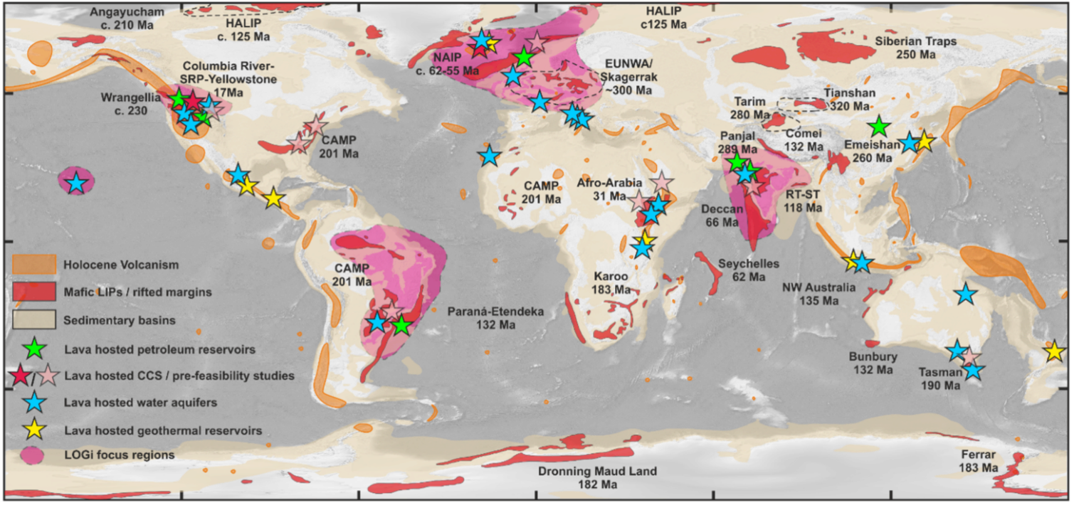
Globally, 100 000’s of boreholes have drilled igneous rocks for hydrocarbon, geothermal, aquifer, and CO2 storage applications. This spectacular borehole archive enables new insights into exploration opportunities of the worlds ancient, buried volcanoes.
Uniform processed data have been provided from TGS R360 which is the world’s largest well log database consisting of 6.2M wells.
Igneous sequences and deposits
have fundamentally different origins, architectures, and physical properties compared to conventional sedimentary basin rock types,
constitute and influence migration pattern, global fluid reservoirs for e.g., ground water and hydrocarbons, and
have a potential major role to play in the energy transition as permanent CO2 storage reservoirs.
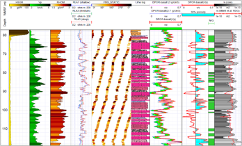
The LOGidatabase
constitutes 120 carefully selected global boreholes penetrating diverse igneous deposits and environments,
many of these boreholes are located in high-quality 3D seismic data cubes, and
selected boreholes include basic wireline data alongside image, chemical, and NMR logs with core calibrations where available.
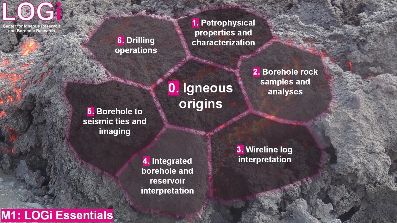
The LOGiproject is used to
develop a unique igneous facies scheme for borehole interpretation and ML,
develop and calibrate volcanic basin petrophysical and reservoir models, and
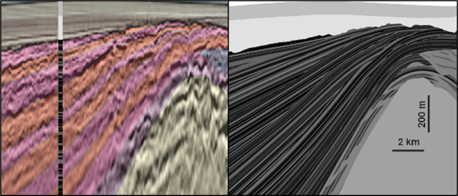
develop Earth models useful to aid seismic imaging and interpretation.
Key importance: A unique igneous borehole interpretation data base for work-flow, igneous-influenced reservoir models, guidance on seismic imaging of volcanic basins.
Solution
Sub-surface Igneous Integration
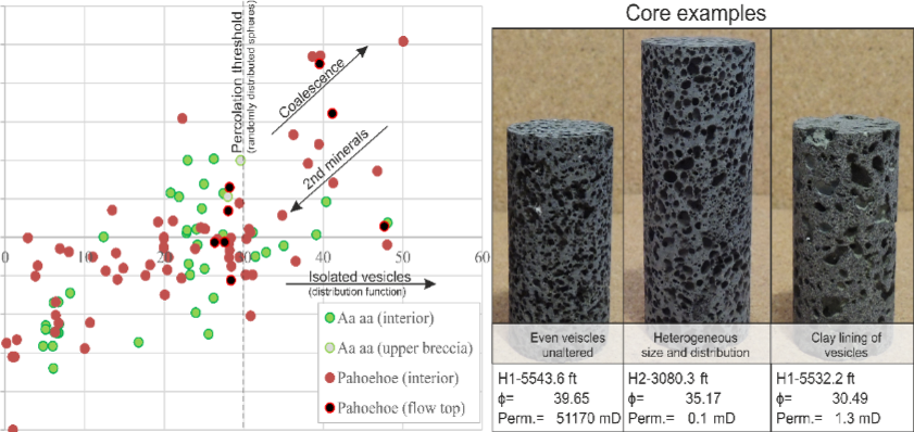
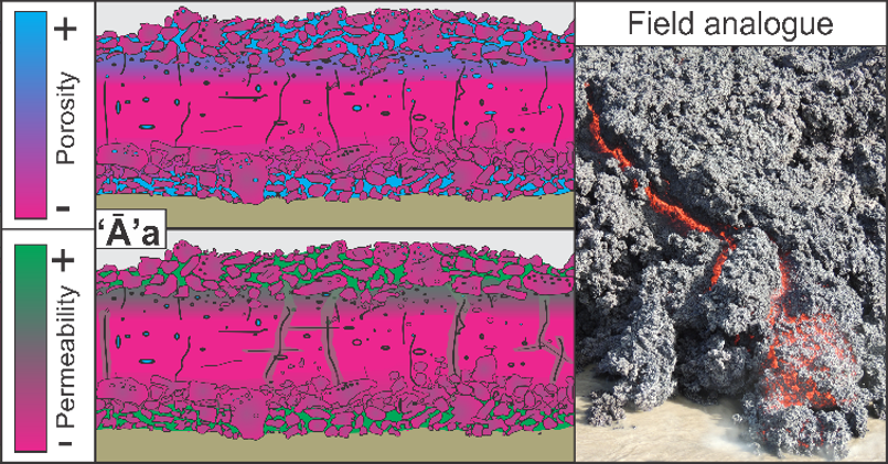
Petrophysical facies calibration
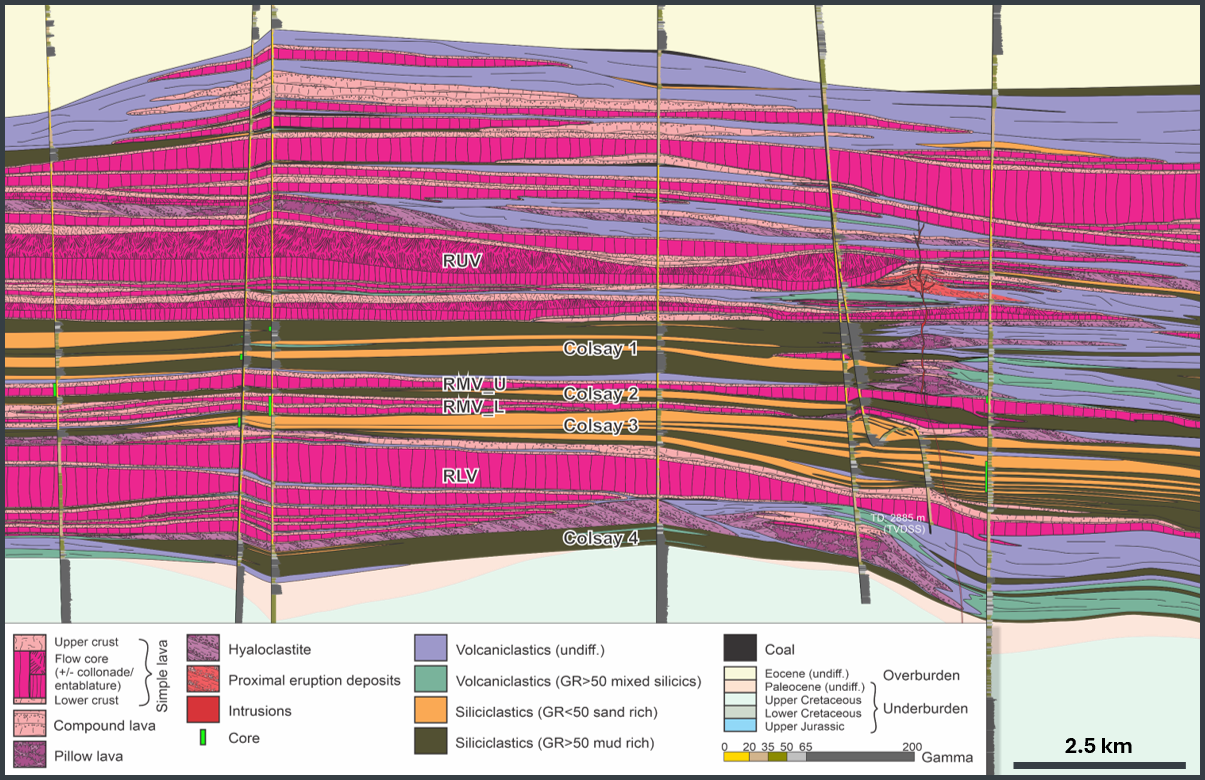
2D volcanic facies models
Reservoir property distribution
Seismic calibration and reservoir models
Wireline interpretation and modeling

Seismic modeling