P - C A B L E D A T A
P-Cable
VBER is the co-owner of an extensive multi-client P-Cable database in the Barents and Norwegian seas, and will continue to work closely with P-Cable companies to develop new multi-client surveys world-wide.
VBER holds unique operational experience and technical knowledge of the P-Cable technology through our role in the development of the technology. The company was the leading developer of the P-Cable high-resolution 3D seismic technology in 2001, and a co-founder of the P-Cable 3D Seismic AS (P3S) company in 2008. P3S was sold to the Houston-based company NCS Subsea in July 2016 (See company history).
Products / Multi-Client Data
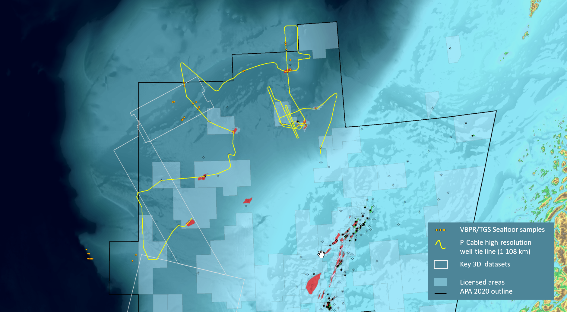
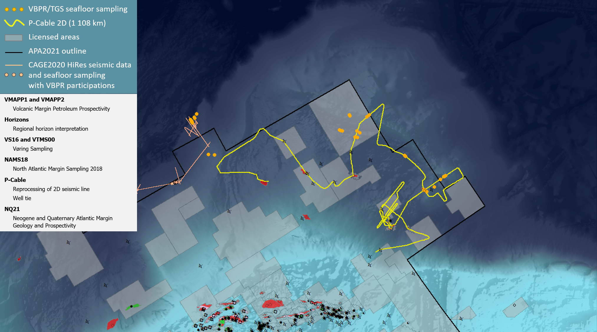
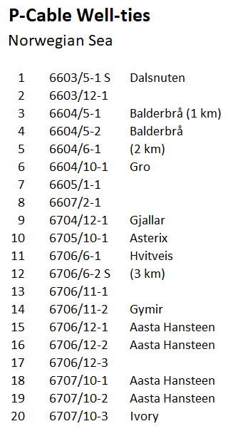
2D wide azimuth profile (1108 km) tying 20 exploration wells in the outer Vøring Basin.

3D cubes over high-graded prospects, and 2D wide azimuth profiles tying 30 exploration wells across the Norwegian Barents Sea
P-Cable | Norwegian Sea
Our multi-client library consists of 1108 km of wide-azimuth 2D P-Cable seismic profiles. The survey was acquired in the outer parts of the Vøring Basin, providing high resolution well-ties to 20 explorations wells, a number of NPD shallow wells, and to many sites of the VS16 Seafloor Sampling program.
The data has been acquired in collaboration with TGS and WGP Survey. Please contact us or TGS for more details on the available data.
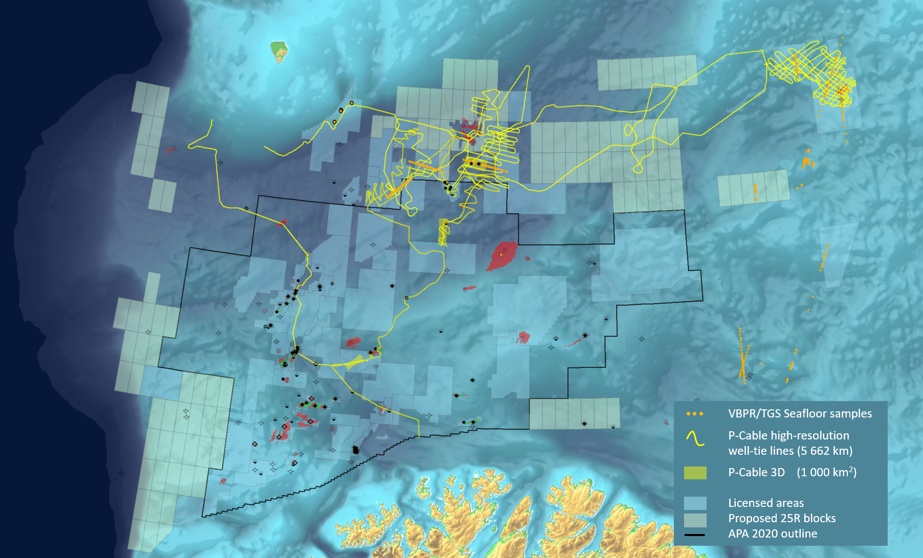
P-Cable | Barents Sea
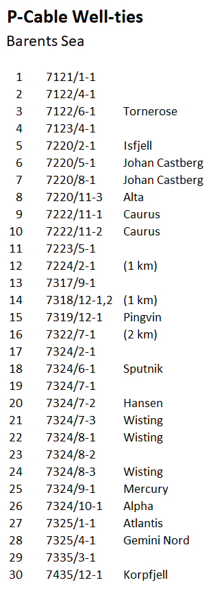
Our multi-client library consists of 15 high-resolution 3D cubes and more than 5600 km of wide-azimuth 2D P-Cable seismic profiles. The surveys are located in the Norwegian Barents Sea, providing high resolution well ties to 30 key exploration wells, a high number of shallow NPD wells, and to our extensive Seafloor Sampling programs.
The focus of the acquisition was on Fingerdjupet/Hoop (HR14) and the Barents SE (HR15) areas for the 22nd and 23rd licensing round, but still offer valuable stratigraphic correlations to untested opportunities in the new 25R licenses and in the ongoing APA21 licensing round.
The data has been acquired in collaboration with TGS and WGP Survey. Please contact us or TGS for more details on the available data.
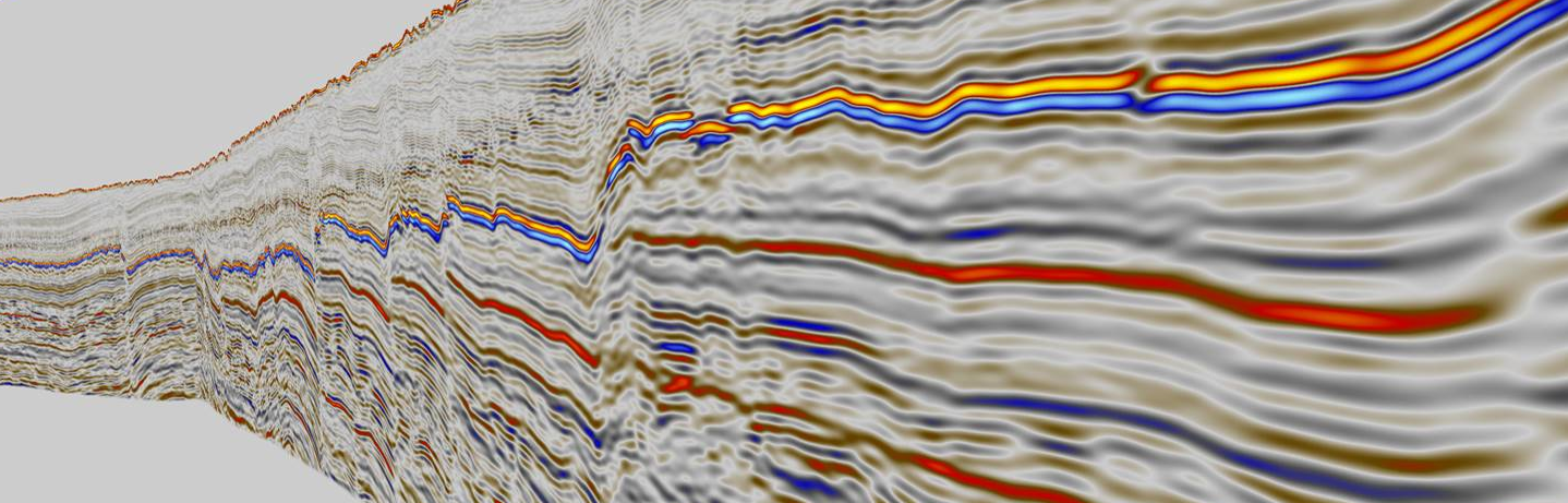
From P-Cable Wide Azimuth Profile HR2015, Bjarmeland Platform, Barents Sea.